Home / Neighborhoods / Brentwood
Brentwood Homes for Sale
Estate streets, country marts and the Westside’s most complete family neighborhood.
Home / Neighborhoods / Brentwood
Estate streets, country marts and the Westside’s most complete family neighborhood.
About the Neighborhood
Brentwood grew out of the Rancho San Vicente y Santa Monica, whose grazing land west of the Sepulveda pass stayed largely open until the Pacific Branch of the National Home for Disabled Volunteer Soldiers opened in 1888 on land that is now the West Los Angeles VA campus. A small settlement followed the Soldiers' Home, and the Los Angeles Pacific trolley along San Vicente Boulevard tied it to the city. Brentwood Park was laid out in 1906 with wide streets, traffic circles and heavy tree planting, and within roughly three decades the surrounding tract development had taken the Brentwood name; the area was annexed to Los Angeles in 1916.
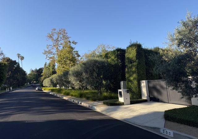
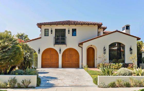
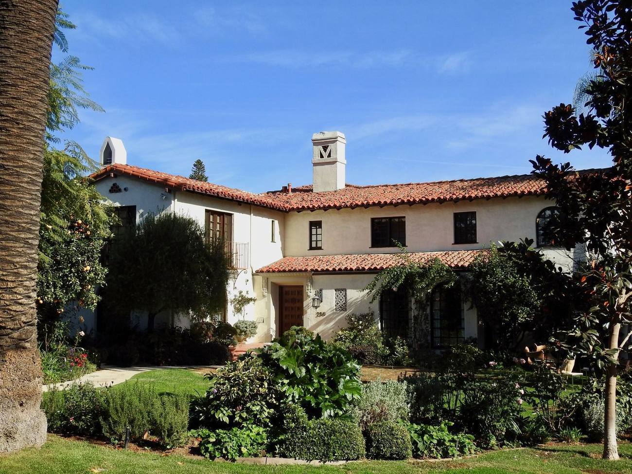
The housing stock splits cleanly by geography. Brentwood Park and the streets off the coral-tree median of San Vicente hold large traditional, Spanish Colonial Revival and newer estate houses on generous lots. Kenter Canyon, Mandeville Canyon and Sullivan Canyon carry ranch houses, midcentury designs and rebuilt contemporaries, with Sullivan Canyon keeping an equestrian character. Crestwood Hills, a postwar cooperative tract planned with architect A. Quincy Jones, is a recognized enclave of modernist houses. South of San Vicente and along Wilshire and Barrington, the stock shifts to condominiums, townhomes and apartment buildings from the 1960s onward.
Building in Brentwood is governed less by a single overlay than by topography. Much of the canyon and ridge land sits inside the city's Baseline Hillside Ordinance rules and mapped Very High Fire Hazard Severity Zones, which shape grading, haul routes and defensible-space requirements. Crestwood Hills is a designated Historic Preservation Overlay Zone, so exterior changes there go through city preservation review. Several canyon associations maintain private streets and architectural guidelines of their own. The January 2025 Palisades fire reached Brentwood's western edge and prompted evacuations, which has sharpened attention on brush clearance and insurance underwriting throughout the hillside sections.
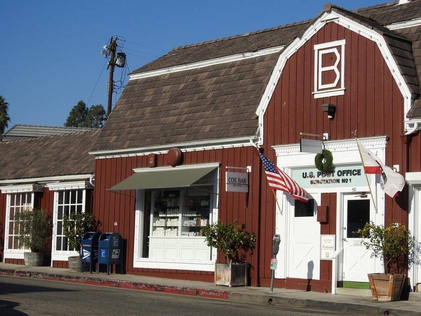
Day to day, Brentwood organizes itself around San Vicente Boulevard, where the median doubles as one of the city's best-known running routes and the Brentwood Country Mart, operating since 1948, anchors the retail strip alongside the Sunday farmers market on Gretna Green. The Getty Center, opened in 1997 above the 405, sits at the neighborhood's eastern shoulder. Commutes are the honest trade-off: Sunset Boulevard and the 405 interchange congest predictably, and canyon residents plan around a single road in and out. Most errands, schools and restaurants, though, sit within a short drive of the flats.
Buyers should verify the specifics that vary lot by lot. In the canyons that means the parcel's fire-severity mapping, current brush-clearance status and, critically, what insurers will actually quote, since some hillside owners now rely on the California FAIR Plan. Hillside parcels warrant geological and soils reports and a check of grading and retaining-wall permits. In Crestwood Hills, check whether a house carries individual Historic-Cultural Monument designation before planning changes; the enclave is protected house by house rather than as an HPOZ. For condominiums south of San Vicente, review association budgets and any pending assessments. School assignment between Kenter Canyon, Brentwood Science Magnet and neighboring boundaries should be confirmed directly with LAUSD for the exact address.
Life Here
The Country Mart’s courtyard fried chicken has fed three generations of the same families. That says everything.
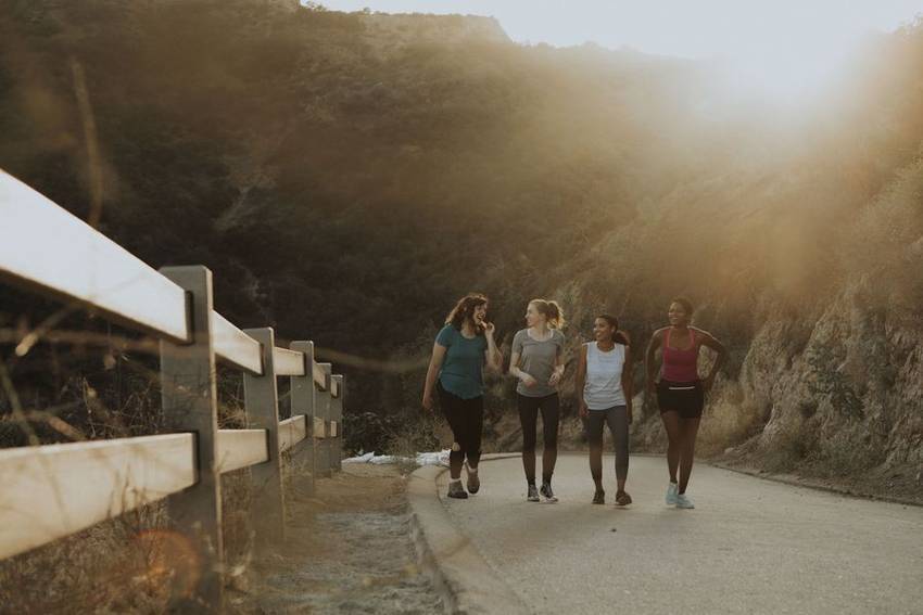
Mandeville and Sullivan run trails into the Santa Monicas from your own street.

The coral trees, the runners, the Saturday scene. The Westside’s best boulevard.
History
Brentwood's land history begins with Rancho San Vicente y Santa Monica, the roughly 30,000-acre grant made to the Sepulveda family in 1839; the heirs sold their holdings in 1872, and the acreage passed through speculators' hands for a generation. The 1888 opening of the Pacific Branch of the National Home for Disabled Volunteer Soldiers, today's VA campus, brought the first real settlement to its edge. The decisive act came in 1906, when the Western Pacific Development Company subdivided Brentwood Park, advertising it in the Los Angeles Times the following spring and claiming some 87,000 trees and shrubs, contour-following oiled streets, and a layout attributed, without surviving evidence, to Golden Gate Park's John McLaren. Los Angeles annexed the district in 1916, and the Brentwood name spread outward from the Park.
San Vicente Boulevard is Brentwood's organizing line, and its median is a historical document. The boulevard was cut in 1905 for the Westgate trolley, which began running in 1906 and stitched the young suburb to Santa Monica and the city; the tracks came out around 1942, and the median was first grassed for horseback riding. The coral trees that define it today were planted in the late 1940s through a Los Angeles Beautiful grant, and in 1976 the city designated them Historic-Cultural Monument No. 148, street trees with landmark status. Just south, the Brentwood Country Club opened its William Watson-designed course in 1916, briefly under the Santa Monica Country Club name, fixing the green mid-line the neighborhood still wraps around.
The postwar decades made Brentwood the Westside's institutional neighborhood. Brentwood School was founded in 1972 on the grounds of the Brentwood Military Academy, which had operated since 1902, and now runs from its West Campus on Sunset to its East Campus on Barrington Place. The Archer School for Girls arrived in 1998, restoring the 1931 Eastern Star Home, a Spanish Colonial Revival landmark by William Mooser II that holds city monument status and joined the National Register in 2020. Mount Saint Mary's University occupies its hillside Chalon campus above the canyons, and the Getty Center opened above the 405 in December 1997. Few residential districts anywhere carry this concentration of campuses, and it shapes both weekday traffic and long-term demand for Brentwood Los Angeles real estate.
Architecture
Brentwood is where Cliff May, the self-taught designer most responsible for the modern California ranch house, built his proving ground. In late 1938 he acquired thirty-six acres beside Sunset Boulevard at the mouth of Sullivan Canyon and laid out Riviera Ranch, a 31-parcel tract recorded in 1940 whose deed restrictions required every residence to be of the California Ranch House type or harmonize with it. May designed more than twenty of the houses himself, most with stables, kept his own house and later his 1949 office at 13151 Sunset inside the enclave, and followed with the 49-parcel Old Ranch Road tract in 1950-51. Bridle trails, board fences, and deep informal courtyards still read exactly as he intended.
The traditional stock carries serious names. SurveyLA, the city's historic resources survey, credits Brentwood Park houses to John Byers, Reginald Johnson, and Paul R. Williams among the revival designers, alongside modernists Richard Neutra, Thornton Abell, Craig Ellwood, and Lloyd Wright, a range few Los Angeles neighborhoods can match on a single street grid. Gerard Colcord, long the film industry's architect of choice for gentleman farmhouses and Colonial designs, worked steadily here as well, and his Brentwood commissions still anchor estate sales decades on. The vocabulary these architects established, Monterey Colonial, American Colonial, Spanish Colonial Revival, and board-and-batten traditional, became the neighborhood's default language, and it is the stock buyers picture when they search Brentwood homes for sale.
Today's construction wave is new-traditional: gated Cape Cods, painted-brick Georgians, and modern farmhouses replacing one-story postwar ranches, particularly on the flats between Sunset and San Vicente, where lot values long ago outran the original houses. Outside Crestwood Hills, where a group of A. Quincy Jones-era houses carry individual Historic-Cultural Monument protection, most of Brentwood has no design review beyond the city's baseline zoning and hillside rules, so the streetscape is rewriting itself parcel by parcel. For buyers this cuts both ways. New construction delivers scale and systems the 1950s never imagined, but provenance matters here, and the difference between an undifferentiated developer spec and an architect-led rebuild tends to reassert itself at resale.
Understanding the Market
Brentwood's market is best understood as three tiers keyed to Sunset and San Vicente. North of Sunset, the canyons, Mandeville, Sullivan, Kenter, and the Tigertail ridge, hold the estate tier: privacy, acreage, and view premiums traded against single-road access and fire-zone underwriting. Between Sunset and San Vicente sit Brentwood Park and the prime flats, where the 1906 tract's hundred-foot frontages and traffic circles support the neighborhood's most consistent trophy values. South of San Vicente, the stock steps down to smaller traditionals, townhomes, and the condominium corridors toward Wilshire and Barrington, which serve as the entry market. The same search, Brentwood homes for sale, spans three genuinely different products, and the pricing logic changes at each boundary.
Private-school gravity is a defining force in this market. Brentwood School's two campuses flank Sunset and Barrington, the Archer School for Girls holds its landmark campus on Sunset, and further independent campuses ring the neighborhood's edges, so families targeting these schools concentrate their searches here and then hold houses for full childhood cycles. That lengthens ownership tenure, thins inventory on the most school-adjacent blocks, and gives the flats an unusually deep family buyer pool. On the public side, LAUSD's local elementaries, including the charter-affiliated Kenter Canyon campus, carry loyal followings of their own, and assignment should always be verified address by address. Living in Brentwood, for many households, is a school decision first and a house decision second.
Guidance for buyers follows the tiers. In the canyons, underwrite the parcel before the house: fire-severity mapping, actual insurance quotes, geology, and the reality of one road in and out at school hour. In Brentwood Park and the flats, study the block face, because original architect-built houses, thoughtful rebuilds, and undifferentiated specs sit side by side with very different long-term trajectories, and frontage and setback vary tract by tract. South of San Vicente, condominium diligence is association diligence: budgets, reserves, and pending work. Everywhere, weigh proximity to the San Vicente median, the Country Mart, and the Village against the boulevard's weekend density. Brentwood Los Angeles real estate rewards buyers who price the tier correctly rather than the zip code.
Micro Neighborhoods
The 1906 Western Pacific Development Company tract remains the neighborhood's formal core: curvilinear streets shaped to the land, surviving landscaped traffic circles, hundred-foot minimum frontages, and setbacks deep enough that houses read as estates. The city's survey credits designs here to John Byers, Reginald Johnson, Paul R. Williams, and Lloyd Wright, with later modernists alongside, though substantial new-traditional construction has since joined them. Bounded broadly by Sunset and San Vicente, the Park trades as Brentwood's blue-chip address: lot value is the floor, provenance sets the ceiling, and the traffic circles still do the quiet work the 1906 plan intended.
Mandeville Canyon runs roughly three miles north from Sunset along a single road often described as the longest dead-end street in Los Angeles. Its prehistory is improbable: an 800-acre California Botanic Garden opened here in January 1928, with Mary Pickford planting the first tree, then failed after the 1929 crash and closed by 1935, after which bondholders subdivided the land as country estates. That origin still shows in deep, planted parcels, ranch houses and gated compounds, an active canyon association, and a rhythm set by the one road. Buyers trade commute flexibility for land, quiet, and genuine seclusion.
Crestwood Hills began in 1946, when four musicians pooled resources into the Mutual Housing Association, a cooperative that grew past 400 members, bought hillside acreage, and hired A. Quincy Jones, Whitney R. Smith, and engineer Edgardo Contini. About 160 experimental post-and-beam houses were built around 1950, along with a cooperative nursery school and a park later given to the city. The 1961 Bel Air fire destroyed dozens; roughly three dozen originals survive, many protected as individual Historic-Cultural Monuments. It remains the Westside's most important cooperative modernist enclave, and originals trade on documentation and design integrity.
Sullivan Canyon is Brentwood's equestrian address. Cliff May chose the canyon's mouth for Riviera Ranch in 1938, and his ranch-house covenant, with its stables, bridle paths, and board fences, set the tone that still governs; the Old Ranch Road tract extended it in 1950-51. Up-canyon, properties sit under sycamores on flat, generous canyon floor rare in Westside topography, many with barns and corrals, and residents steward the riding culture through an active owners' association. Houses range from May originals to substantial contemporary ranches. It is a deliberately unhurried market: low turnover, strong loyalty, and a premium on land that can actually keep horses.
Kenter Canyon climbs north of Sunset between the flats and Crestwood Hills, and its stock tells Brentwood's postwar story in miniature: one-story ranches and midcentury post-and-beams on the lower streets, with rebuilt contemporaries and view houses gaining altitude toward the Tigertail ridge, where city-to-ocean panoramas begin. The canyon's identity is anchored by Kenter Canyon Elementary, a charter-affiliated LAUSD campus with a devoted parent base, and by streets that stay genuinely residential, with no retail and little through traffic. Values track view, lot utility, and rebuild quality; fire-zone mapping and hillside grading rules apply here as they do throughout the canyons.
Brentwood Glen is the pocket tucked between Sunset Boulevard, the VA grounds, and the 405: a compact grid of smaller one- and two-story traditional homes that functions as Brentwood's most attainable single-family entry point. The Glen's appeal is practical, with freeway access that does not require crossing the neighborhood, walkable internal streets, and an active neighborhood association that has long managed the district's relationship with its louder eastern edge. Buyers should weigh that edge honestly, since freeway adjacency varies house by house and matters here, against a price of admission the flats and canyons have not offered in decades.
Brentwood Village at Barrington and Sunset and the San Vicente corridor carry the neighborhood's daily rituals: the Brentwood Country Mart, an open-air center built in 1948 to Rowland Crawford's design; a run of 1928 Spanish Colonial Revival storefronts noted in the city's historic survey; and the coral-tree median that doubles as the Westside's signature running route. The surrounding flat blocks hold traditional homes on walkable streets, the closest thing in Brentwood to village life, and they trade briskly, because walkability plus school proximity is the neighborhood's most requested combination. The Sunday farmers market on Gretna Green completes the routine.
Education
Public-school assignment follows the individual parcel and boundaries do change, so confirm the current resident schools for any address directly with LAUSD before relying on them.
Common Questions
Work With Ben
The best family homes here sell within the neighborhood’s own network first. Tell Ben what you are looking for, including off market.
Start the ConversationBen will reach out shortly to set up your tour.