Home / Neighborhoods / Latigo Shores & Malibu Cove Colony
Two small beach communities either side of Latigo Point, one open to a signed public stairway and one behind a guard gate.
About the Neighborhood
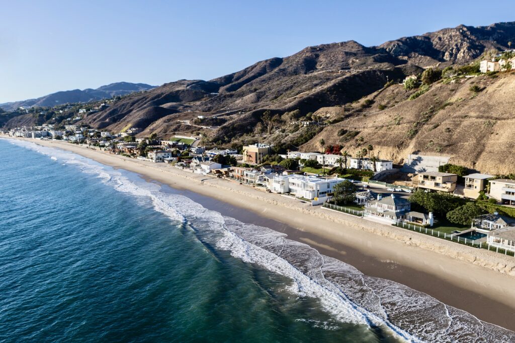
Latigo Shores and Malibu Cove Colony sit within a mile of each other on the Escondido stretch of the Malibu coast, and they are routinely marketed as a pair even though they are structured very differently. Latigo Shore Drive runs along the sand on the eastern side of Latigo Point, an unhurried strip of houses and low condominium buildings reached directly from Pacific Coast Highway. Malibu Cove Colony Drive lies to the east on Escondido Beach and is a single guard-gated street. Buyers comparing Malibu beachfront homes in this stretch are really choosing between an open street with recorded public easements and a gated one — and the difference is worth understanding before the offer, not after.
Latigo is the more public of the two, by design. The California Coastal Commission's Malibu beach guide lists Latigo Beach as an access point at Latigo Shore Road, with visitors directed to park on Pacific Coast Highway, and a signed coastal access stairway drops to the sand beside the condominiums near the street entrance. Beach-access guides describe the easements here as unusually well defined — buffers of roughly sixteen feet from the first several condominium buildings and about ten feet from the next few — with most of the wet and dry sand consequently public. Latigo Point shelters the beach from the west, and tide pools sit at its western end.
Malibu Cove Colony is the tighter, quieter proposition. Brokerage guides consistently describe a single guard-gated street of about fifty-one houses fronting Escondido Beach, with an active homeowners association maintaining the common landscape — figures that are widely repeated in the market but are not published by the city, so treat them as directional. Escondido Beach itself is not closed water: there is a public gate at the Escondido Creek bridge near 27148 Pacific Coast Highway and a public stairway west of Geoffrey's, near 27420 Pacific Coast Highway, and the state has continued to formalize those routes. The gate controls the street, not the shoreline.
The neighborhood context is small-scale and inland-facing. Across Pacific Coast Highway, the city's Local Coastal Program describes the Sycamore Park community — Via Escondido, Sea Vista and Sycamore Meadows — as a residential pocket sitting opposite Escondido Beach and Cove Colony, with densities ranging from about one home per half acre to one per six acres and houses running roughly two thousand to eight thousand square feet. Via Escondido follows Escondido Creek and carries a bridge that lets residents reach the beach without crossing the highway. Escondido Canyon rises behind, with its waterfall trail, and Dan Blocker Beach lies just east at 26000 Pacific Coast Highway.
Diligence in this stretch is easement diligence. Ask for the recorded lateral access easement affecting the parcel and the exact setback distance it specifies, because on Latigo those distances vary building by building. On Malibu Cove Colony Drive, request the association's governing documents, the private road maintenance arrangement and the gate operation before assuming anything about what the gate does and does not cover. Both areas rely on onsite wastewater systems, so the septic design and its permitted capacity determine what a remodel can add. Review shoreline protection, geotechnical findings and the coastal permit file for any structure standing on the sand.
Life Here
A signed coastal access stairway drops to Latigo Beach beside the condominiums at the street entrance, with parking on Pacific Coast Highway. Recorded easements define the buffers, so most of the wet and dry sand here is public.
Malibu Cove Colony Drive is a single gated street on Escondido Beach, commonly described as about fifty-one houses with an active homeowners association. The gate controls the road; the shoreline below remains reachable by recorded public routes.
Latigo Point shelters the beach from the west and holds tide pools; Escondido Creek runs to the sand under the highway; Escondido Canyon climbs inland to its waterfall trail. Dan Blocker Beach sits just east at 26000 PCH.
Education
These addresses currently sit within the Santa Monica-Malibu Unified School District. Separation agreements creating a Malibu district were approved locally in December 2025 but still require state action, and no opening date is confirmed. Verify boundaries and enrollment policy with the district for any specific parcel.
Common Questions
Work With Ben
These are small streets where inventory is measured in a handful of houses a year. Tell me which side of Latigo Point you want and I will watch both, including the quiet sales.
Start the ConversationBen will reach out shortly to set up your tour.