Home / Neighborhoods / Malibu
Malibu Homes for Sale
Twenty seven miles of coastline: beach compounds, bluff estates and the most famous stretch of Pacific in the world.
Home / Neighborhoods / Malibu
Twenty seven miles of coastline: beach compounds, bluff estates and the most famous stretch of Pacific in the world.
About the Neighborhood
Malibu's modern story begins with Rancho Topanga Malibu Sequit, the roughly 13,300-acre Spanish land grant that Frederick and May Rindge bought in 1892. After Frederick's death in 1905, May Rindge spent decades fighting public road access across the ranch, a battle she finally lost when the state opened the Roosevelt Highway, today's Pacific Coast Highway, in 1929. Leased lots at the Malibu Colony in the late 1920s brought the first film-industry beach houses, and piecemeal subdivision followed along the coast and up the canyons. The city incorporated in 1991, largely to gain control over land use, and took the motto '21 miles of scenic beauty' as a literal description of its coastline.
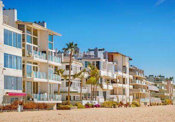
The housing stock tracks the geography. Beachfront rows at Malibu Colony, Carbon Beach, La Costa, and Broad Beach stand shoulder to shoulder on the sand, many on caisson foundations behind bulkheads or rock revetments. Point Dume and the mesas carry ranch houses from the 1950s and 1960s, often on half-acre and larger lots, with equestrian zoning in places. The canyons, from Corral and Latigo to Ramirez and Encinal, mix architect-built contemporary homes with older cabins on private roads. Much of the city relies on onsite wastewater treatment systems rather than sewers, a practical fact that shapes the scope of many remodels and additions.
Every Malibu parcel sits inside the California coastal zone. The city's Local Coastal Program, certified by the Coastal Commission in 2002, lets Malibu issue its own coastal development permits, though decisions in mapped appeal areas can be taken to the Commission. In January 2025 the Palisades fire burned into eastern Malibu, destroying homes along the Pacific Coast Highway corridor and in the Big Rock and Las Flores neighborhoods. Rebuilding is under way through city permitting; like-for-like rebuilds of fire-destroyed homes, generally up to 110 percent of the prior structure's size, are exempt from new coastal permits, while enlargements beyond that threshold trigger fuller review.
Daily life runs along one artery. PCH carries commutes, school runs, and summer beach traffic alike, and residents learn to plan around it. Groceries and errands cluster at the Civic Center, Point Dume, and Trancas shopping centers, and the farmers market and school events double as the town square. Zuma and Westward beaches, the Point Dume headlands, and Santa Monica Mountains trailheads sit within minutes of most addresses, which is much of the point of living here. From October through January, wind season keeps evacuation planning and brush clearance part of ordinary household routine rather than an abstraction, and neighbors talk about both freely.
Buyers should verify more here than in most Los Angeles markets: the coastal permit file and any unpermitted additions; geology and bluff-retreat reports on oceanfront and hillside lots; the capacity and permit status of the septic system; recorded public-access easements on beachfront parcels; and fire-hazard-zone mapping alongside realistic insurance quotes, since many owners now combine a California FAIR Plan policy with supplemental coverage. On fire-affected streets in eastern Malibu, confirm the parcel's rebuild status and what is happening on neighboring lots. Escrow periods commonly stretch to accommodate these inspections; experienced local agents treat that as normal practice rather than a red flag.
Life Here
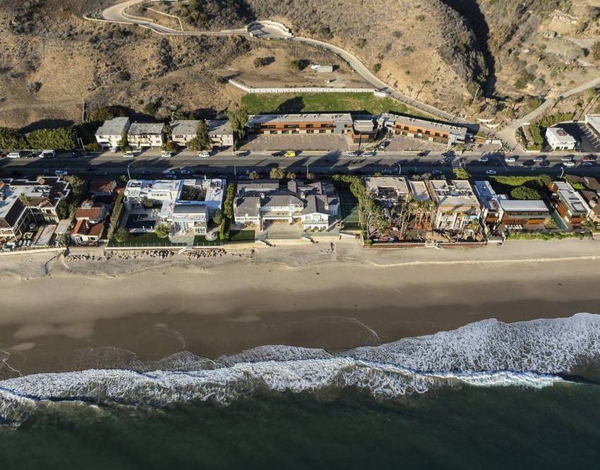
From the Colony to Carbon, beachfront trades in a currency of linear feet on the water.

Point Dume and the bluff estates: acreage, horse rings and stairs down to private coves.
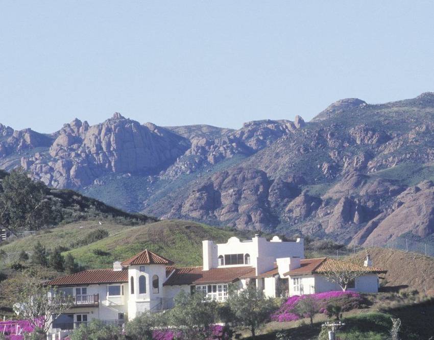
Behind PCH the canyons hide vineyards, ranches and moderns with whitewater views.
History
Malibu's modern history starts with a single deed. Frederick Hastings Rindge bought Rancho Topanga Malibu Sequit, some 13,300 acres of Spanish land grant, in 1892, and after his death in 1905 his widow May spent three decades defending it. She formed the Marblehead Land Company, laid fifteen miles of private railroad track along the beach between 1906 and 1908 to keep the Southern Pacific out, and litigated road access to the United States Supreme Court, which ruled for the public. The state's Roosevelt Highway, today's Pacific Coast Highway, opened through the ranch in 1929. Malibu Potteries, which she founded in 1926 under ceramicist Rufus B. Keeler, closed in 1932; its tile survives at the Adamson House.
The Malibu Colony began as a cash-flow measure. In 1926 May Rindge started leasing narrow beachfront lots west of the lagoon to film-industry tenants, who built cottages on ground they did not own, an arrangement that gave the place its Movie Colony name. Those leaseholds later converted to fee ownership, and the Colony is today a private gated lane of roughly a hundred houses, by common accounts, behind one of the most recognized gates on the California coast. The same period produced the fifty-room mansion May was building on Serra Hill, abandoned unfinished in 1932 as the Potteries burned and her money ran out, and sold to the Franciscan Friars in 1942 for $50,000.
Malibu was governed from Los Angeles County until 1991, when residents voted to incorporate, largely to take control of land use along a coast the county had been planning for them. Municipal control changed what could be built and how quickly: the city wrote its own zoning, declined the large-scale sewering that would have enabled density, and organized a general plan around the twenty-one miles of shoreline it advertises. The second half of that story arrived in 2002, when the California Coastal Commission certified Malibu's Local Coastal Program. Because the entire city lies within the coastal zone, that certification is what allows Malibu to issue its own coastal development permits, subject to Commission appeal in mapped areas.
Architecture
The Malibu beach house is a type before it is a style. On the sand at the Colony, Carbon Beach and Malibu Road, lots run narrow and deep; the city's own neighborhood descriptions put many Malibu Road beachfront parcels near sixty by one hundred feet. Houses therefore present a closed, almost defensive face to the highway and open entirely to the water. Living space stacks toward the view, decks cantilever seaward, and the whole assembly typically stands on concrete caissons or driven piers set below scour depth, often behind a bulkhead or rock revetment. The result reads as modest from the road and expansive from the beach, which is precisely the intent.
The named-architect coastline runs from mid-century through the present. Richard Neutra's 1948 Holiday House above the highway survives as the building occupied by Geoffrey's Malibu, and his 1957 Cohen House II sits above Escondido Beach. John Lautner built five Malibu residences, Stevens in 1968, Garwood in 1970, Beyer in 1975, Segel in 1980 and Krause in 1982, sculptural concrete work that treated the beach house as landscape rather than as a box on a lot. Edward R. Niles, FAIA, has spent a career on glass-and-steel houses in the canyons and on the bluffs. Among current practices, Scott Mitchell Studio, which also designed Nobu Malibu, and Kovac Design Studio show documented Malibu residences.
Building here is a permitting exercise before it is a design exercise. Every parcel sits in the coastal zone, so most work requires a coastal development permit issued by the city under its Local Coastal Program, with Commission appeal available in mapped areas. Oceanfront projects add coastal-engineering review: wave uprush analysis prepared by a coastal engineer and FEMA base flood elevation compliance, plus geotechnical work and, on bluffs and hillsides, slope-stability review. Most of Malibu is not sewered, so onsite wastewater treatment systems govern what a house can be, through percolation tests, soils and geology reports, fixture-unit worksheets, advanced treatment on beachfront and multifamily sites, and city operating permits thereafter.
Understanding the Market
Malibu prices by stretch, not by median. Carbon Beach, widely called Billionaire's Beach, and the gated Malibu Colony anchor the top of the sand market, and with it the small universe of oceanfront homes Los Angeles County has to sell. Point Dume sells lot size and bluff position: the city's neighborhood profile describes original two-thousand-square-foot ranch houses on unusually large oceanside parcels, with post-1985 construction often exceeding eight thousand. Broad Beach carries both its sand-restoration history and its west-end privacy. Serra Retreat is a wooded canyon pocket of about ninety-six properties on half-acre to four-acre parcels. Zuma and Trancas trade beach adjacency for space, and the inland canyons offer acreage on private roads. One brokerage report put Malibu's second-quarter 2026 median near $4.1 million across 48 sales.
Owning beachfront in California is narrower than it looks. Private title generally runs to the mean high tide line, an ambulatory boundary, and everything seaward of it is public trust land, which is why the wet sand in front of a Malibu house is legally open to anyone who reaches it lawfully. Many oceanfront parcels also carry recorded lateral or vertical access easements, some dedicated decades ago and opened much later; the Carbon Beach West accessway opened to the public in July 2015 after a long enforcement fight. Sand itself is not permanent. Broad Beach owners formed a Geologic Hazard Abatement District in 2011 and won a Coastal Commission permit in 2015 for a nourishment program that has advanced slowly.
Due diligence in Malibu runs longer than elsewhere, and that is normal rather than a warning sign. Pull the coastal permit file and reconcile it against what is standing, since unpermitted decks, additions and hardscape are common and expensive to legalize. Confirm the septic system's capacity, condition and operating permit before assuming a bedroom count. Order geotechnical review and, on the sand, wave uprush analysis. Read the title report for access easements. Price insurance early, since the city sits in a high fire hazard area and many owners now combine a California FAIR Plan policy with a wrap-around policy. In fire-affected eastern Malibu, where roughly 720 homes were lost, confirm each parcel's rebuild status individually.
Micro Neighborhoods
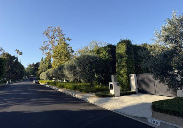
The headland neighborhood, and the closest thing in Malibu to a residential plateau. The city's own profile notes a predominance of single-family homes on extremely large lots, no sidewalks or street lights, and a deliberately rural feel; original 1950s and 1960s ranch houses of around two thousand square feet sit beside post-1985 replacements many times that size. Streets run out to bluff edges above Little Dume and Westward, with Point Dume State Natural Preserve at the tip and Zuma Beach immediately west. Some tracts hold association rights to private beach access. Equestrian zoning survives in places, and the mesa's flat pads simplify construction relative to Malibu's canyons.
View Point DumeThe original film colony, begun in 1926 when May Rindge leased narrow beachfront lots to studio tenants who could not buy the land beneath them. Leaseholds converted to fee over time, and the Colony is now a gated private lane of roughly a hundred houses on the sand west of Malibu Lagoon, with a small commercial center outside the gate. Lots are tight and side yards minimal, so the architecture runs vertical and inward-facing, opening entirely to the beach. Buyers here trade acreage for address and for a stretch of sand that is genuinely quiet. Expect strict permitting, caisson foundations and a long, careful escrow.
View Malibu ColonyA wide west-end stretch beyond Trancas, historically among the most private beaches in Malibu and the site of the coast's most-watched erosion story. Homeowners formed the Broad Beach Geologic Hazard Abatement District in 2011 and won a consolidated Coastal Commission permit in 2015 and State Lands Commission approval in 2016 for sand nourishment, dune restoration and retention of the existing rock revetment, intended to restore a dry beach on the order of sixty-five to seventy-five feet. Implementation has moved slowly. Buyers should read the district's assessment structure and current status alongside the usual geotechnical and wave uprush review.
View Broad BeachKnown widely as Billionaire's Beach, the compact run of oceanfront lots just east of the Malibu Pier, wedged between Pacific Coast Highway and the sand. Houses sit shoulder to shoulder on narrow parcels, most on caissons behind bulkheads, presenting garage doors to the highway and full glass to the water. It has also been a front line of California beach-access enforcement: the Carbon Beach West accessway opened to the public in July 2015 after a protracted dispute, and other easements along the row have been opened over the years. Expect close scrutiny of any permit, addition or shoreline structure on this stretch.
View Carbon BeachA wooded canyon enclave behind the Civic Center, named for the Franciscan retreat house that occupies the hill where May Rindge intended her unfinished fifty-room mansion; the Friars bought the property in 1942. The city's neighborhood profile counts roughly ninety-six properties on parcels from half an acre to four acres and more, describing small, secluded homes and a treasured rural character, though larger estates have since been built. The appeal is a canyon setting minutes from Malibu Road, Cross Creek and the pier, with ocean and mountain views from the upper parcels. Access is limited, privacy is the point, and geotechnical and flood review matter here.
View Serra RetreatThe stretch from Zuma Beach west to the Trancas commercial center is where Malibu becomes less about the sand and more about space. Zuma is a broad county beach with its own parking, which keeps adjacent housing quieter than the beach's popularity suggests. Trancas holds the shopping center that functions as the west end's errand hub, with Malibu West and Malibu Park nearby. The city's neighborhood descriptions record a mix here: roughly two hundred single-family homes in the sixteen-hundred to twenty-six-hundred-square-foot range, condominiums, larger estates on ten-acre-plus parcels in Trancas Highlands, and horse ranches on one- to twelve-acre lots.
Malibu's largest neighborhood by area, spread across a coastal shelf that rises from fifty-foot bluffs to roughly 350 feet above the ocean north of Zuma. It is overwhelmingly single-family on large parcels, one to four acres on average according to the city's own description, and was farmed before it was subdivided, which explains the open, unlandscaped feel of many streets. Newer construction has reached considerable size. Buyers come for acreage, views over Zuma and Point Dume, and room for horses or a guest structure, and accept exposure to wind, brush-clearance obligations and genuine reliance on Pacific Coast Highway.
Behind the beach, Malibu runs uphill into canyons that hold much of its land and little of its publicity: Corral, Latigo, Ramirez, Encinal, Zuma Canyon, Las Flores and Carbon. The city's profiles describe roughly fifty to sixty homes on three- to five-acre lots in gated Ramirez, about fifty estates averaging three acres in pastoral Zuma Canyon with orchards and stables, and denser, more eclectic housing in Las Flores. Roads are often private and shared, water pressure and access are real questions, and several canyons carry Significant Ecological Area designations. The reward is acreage, quiet and ocean views without oceanfront pricing.
Education
All four public campuses currently belong to Santa Monica-Malibu Unified; separation agreements for an independent Malibu district were approved in late 2025 but state-level steps remain, and school assignment always follows the individual parcel, so confirm any address directly with the district before relying on it.
Common Questions
Work With Ben
Beachfront here trades quietly among neighbors first. Tell Ben what you are looking for, including off market.
Start the ConversationBen will reach out shortly to set up your tour.