Home / Neighborhoods / Studio City
Studio City Homes for Sale
A San Fernando Valley studio town on the Los Angeles River, below Mulholland Drive.
Home / Neighborhoods / Studio City
A San Fernando Valley studio town on the Los Angeles River, below Mulholland Drive.
About the Neighborhood
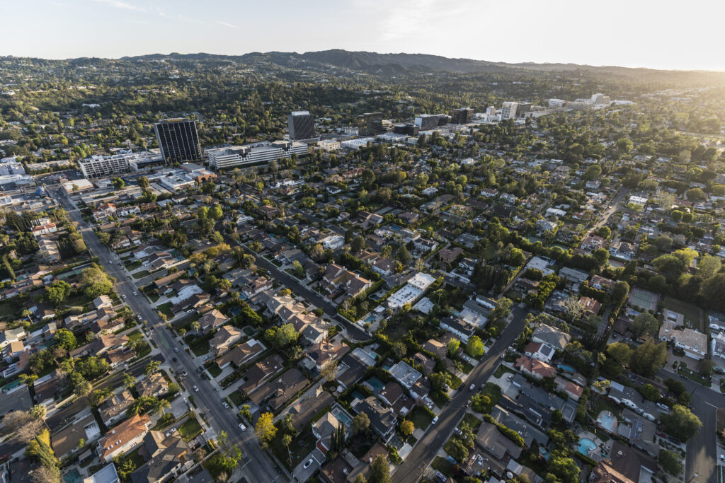
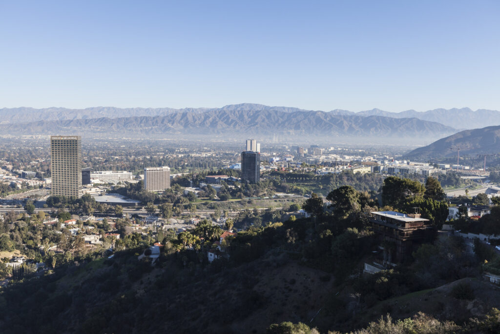
Studio City occupies roughly 6.31 square miles of the southeast San Fernando Valley, immediately west of the Cahuenga Pass, inside Los Angeles Council District 4 and served mainly by the 91604 ZIP code. The ground was part of Rancho Ex-Mission San Fernando, a Mexican land grant of 116,858 acres made in 1846, and stayed agricultural until water arrived. The Los Angeles Aqueduct was completed in 1913, and on March 29, 1915 Valley voters approved annexation to the City of Los Angeles by 681 to 25, adding roughly 170 square miles. Almost everything a Studio City buyer encounters follows from that vote: city zoning and building rules, LAFD service, LADWP water and power, LAUSD school assignment, and the City of Los Angeles transfer tax.
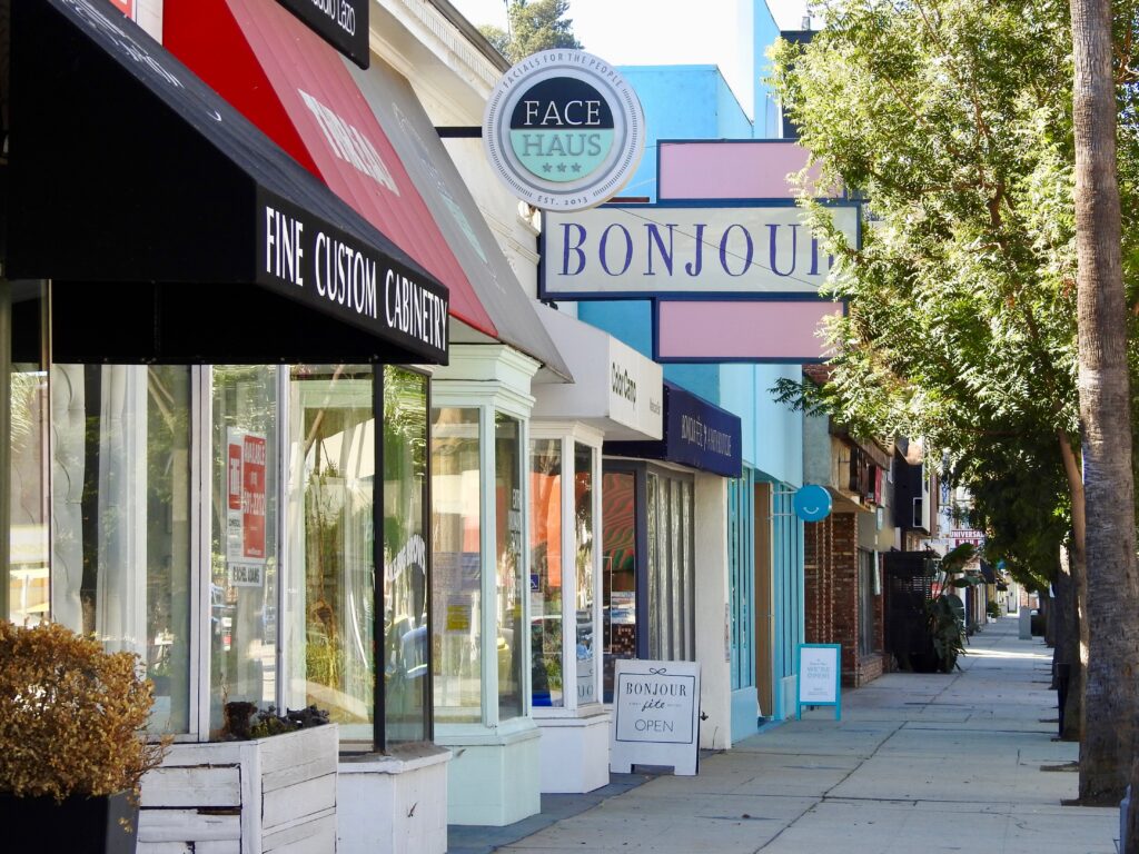
Ventura Boulevard runs the length of the community and functions as its organizing line. The route traces the commemorative El Camino Real and carried U.S. Route 101 before the freeway was built, and sources place its length between roughly 16.5 and 18 miles, from Woodland Hills east to the point where it becomes Cahuenga Boulevard. In Studio City the boulevard is the retail spine, and the phrase homes south of the boulevard describes everything between it and the ridge. North of the boulevard the grid runs flat toward Moorpark Street, the Los Angeles River channel and the Ventura Freeway. South of it the streets climb almost immediately toward Mulholland Drive. Buyers use the phrase as shorthand for that shift in terrain, lot character and price.
The name is literal. Radford Studio Center, at 4024 North Radford Avenue, is the lot Mack Sennett opened in 1928, and the community took its name from the Studio City post office that opened the same year. The historic property runs about 70 acres and holds eighteen sound stages of roughly 7,000 to 25,000 square feet, plus around 220,000 square feet of offices. Gunsmoke, The Mary Tyler Moore Show, Seinfeld and Parks and Recreation were all produced there. An application on file with Los Angeles City Planning, case ENV-2023-1348-EIR, would adopt a Radford Studio Center Specific Plan across roughly 55 acres at 4024, 4064 and 4200 North Radford Avenue, allowing up to 2.2 million square feet at buildout. A draft environmental impact report circulated into April 2025.
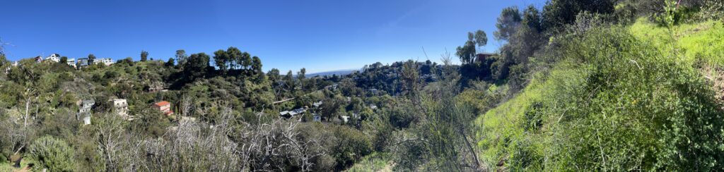
The southern hills are largely public land. Wilacre Park covers 128 acres at 3431 Fryman Road and Fryman Canyon Park covers 122 acres at 8401 Mulholland Drive, both managed by the Mountains Recreation and Conservation Authority, and both sit on the Betty B. Dearing Trail, the cross-mountain route continuing to Coldwater Canyon Park and Franklin Canyon. The habitat is chaparral, walnut woodland and coastal sage scrub, and mountain bikes are excluded from the Fryman segment. On the north edge the Los Angeles River runs in its concrete channel, with the Zev Yaroslavsky L.A. River Greenway Trail, a half-mile path on the north bank. Woodbridge Park, Moorpark Park, South Weddington Park and the Studio City Recreation Center at 12621 Rye Street fill in the flats.
Studio City is unusually regulated for a Valley neighborhood, and the rules explain why two houses on identical lots can end up very different sizes. A Residential Floor Area district adopted by Ordinance No. 182048 covers R1 and RE property in the Studio City portion of the community plan area. The citywide Baseline Mansionization Ordinance and Baseline Hillside Ordinance sit alongside it, the Mulholland Scenic Parkway Specific Plan governs the ridge, and the Ventura-Cahuenga Boulevard Corridor Specific Plan, Ordinance No. 166,560, governs the commercial frontage. The Studio City Residents Association co-runs the Sunday farmers market with the Studio City Chamber of Commerce Foundation on Ventura Place between Radford Avenue and Laurel Canyon Boulevard, 8 a.m. to 1 p.m.
Life Here
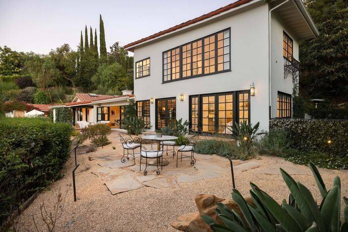
The Silver Triangle’s blocks trade on school lines and remodel quality, and everyone knows both.
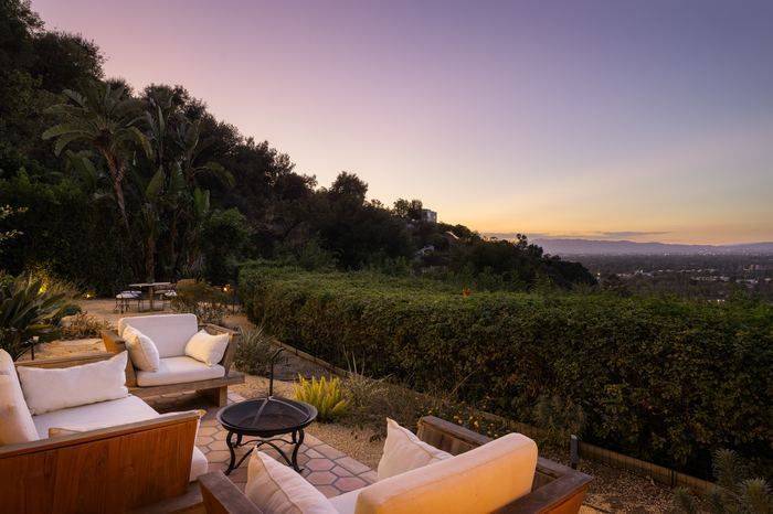
The canyon trailhead is the neighborhood gym, and the hillside streets above it hold the views.
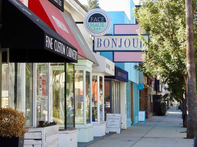
Sushi row, the farmers market and the industry’s favorite breakfasts, all on Ventura.
History
The subdivision came first and the studio was the bait. In 1927 a syndicate incorporated as Central Motion Picture District Inc. assembled more than 500 acres between Tujunga Avenue and what is now Laurel Canyon Boulevard, and between Ventura Boulevard and Chandler Way, on the model of Chicago's Central Manufacturing District. Harry Merrick conceived the scheme and Milton E. Hoffman served as president. Clearing the site meant removing roughly 275 acres of plum, peach and apricot orchards, 60 acres of walnuts and 25 acres of grapevines. Mack Sennett was given 20 acres as an inducement, his roughly $800,000 studio opened on March 18, 1928, and Hoffman Street and Guerin Street still carry names from the venture.
The lot outlasted the syndicate. Sennett went bankrupt in 1932, Mascot Pictures took the plant, and the 1935 consolidation that produced Republic Pictures made it Republic's home. CBS bought the roughly 70-acre property in February 1967 for about $9.5 million. It ran as CBS/Fox Studios from 1982, then as CBS-MTM, and returned to sole CBS ownership as CBS Studio Center in March 1992. Hackman Capital Partners and Square Mile Capital Management bought it in November 2021 in a reported $1.85 billion transaction and renamed it Radford Studio Center. Reporting during 2026 describes lenders taking control after a mortgage default and Netflix pursuing the property, though accounts differ on how far that sale has progressed.
Residential Studio City filled in around the lot in identifiable waves, recorded in the city's own survey documentation. Laurel Terrace, about twelve blocks bounded by Vantage Avenue and Laurel Canyon Boulevard on the east, Laurel Terrace Drive on the south and west and Ventura Boulevard on the north, is identified as one of the earliest neighborhoods, built out from 1923 to 1953. The Agnes Avenue houses between Woodbridge Street and Valleyheart Drive went up in 1937 and 1938. Briarcliff Manor, in the hills off Iredell Street and Oakdell Road, ran from 1933 to 1962. Builder Milton Whitebook's Laurelwood tract added the Dona streets in 1958 and 1960, and Eureka Summit on upper Wrightwood Drive dates to 1961 through 1963.
Architecture
The oldest surviving stock is modest and traditional. Los Angeles City Planning documentation for Laurel Terrace counts 328 properties with 185 contributors, most built between the late 1920s and the mid-1940s, in Spanish Colonial Revival, American Colonial Revival, Minimal Traditional and Ranch forms, and characterizes them as housing for entertainment industry workers rather than executives. The five Agnes Avenue houses of 1937 and 1938 are read as an American Colonial Revival group. That is the baseline on many flat streets: small single-story houses on rectangular lots, often altered at the rear, often still carrying original tile, coved plaster and arched openings, and often the subject of a rebuild proposal.
Postwar Studio City split between valley-floor ranch and hillside modern. Briarcliff Manor, 42 properties with 27 contributors, is described as custom Period Revival and Ranch residences built for an automobile suburb tied to the studios, spanning 1933 to 1962 and concentrated in the 1940s. The Eureka Summit district on the southern stretch of Wrightwood Drive, which climbs from Vineland Avenue to Mulholland Drive, is Mid-Century Modern: 14 properties with 9 contributors, built 1961 to 1963, with the city's assessment noting designs that prioritize view and site over conventional suburban planning. That distinction still holds. Hillside houses here are organized around glass walls, decks and downhill structure; flats houses are organized around a yard.
Since the 1990s the dominant activity has been replacement, and a new-build Studio City farmhouse is a specific product rather than a style label. It is typically a two-story house on a flat lot, board-and-batten or smooth stucco with a dark standing-seam or composition roof, steel-framed glass doors onto a rear yard and pool, an open kitchen and great room across the back, and a detached accessory dwelling unit behind. Its proportions are set by regulation as much as by taste. Ordinance No. 184802, approved March 1, 2017, caps residential floor area at 45 percent of lot area in R1 outside hillside and coastal areas, imposes an encroachment plane on height above 20 feet, and requires facade articulation.
Understanding the Market
Price in Studio City is driven by a short list of variables, and position relative to Ventura Boulevard leads it. South of the boulevard buys shorter access to the canyon roads and the Westside, proximity to the hillside parks, and the older custom housing that grew up on the slope. North of the boulevard generally buys more land per dollar, quieter through traffic, and closer access to the studio gates and the Ventura Freeway. After that the order runs roughly: flat lot versus hillside, usable lot size, whether the house is original or a recent rebuild, whether the parcel sits inside the Carpenter Community Charter attendance area, and how much residential floor area the parcel is actually allowed.
Hillside parcels price differently because they build differently. The Baseline Hillside Ordinance, Ordinance No. 181624 of 2011, ties permitted floor area and grading to slope. Land inside the Mulholland Scenic Parkway Specific Plan, Ordinance No. 167,943 adopted May 13, 1992, also faces a Design Review Board and hard limits. In the Inner Corridor, defined as the right of way plus 500 feet, upslope lots within 100 feet are held to 15 feet in height, and grading is capped at one cubic yard per four square feet of lot area. Downslope lots and the Outer Corridor reach 40 feet. Two hillside lots with similar views can therefore support very different houses, and that shows up in land value.
Transaction cost is a City of Los Angeles question, because Studio City is inside the city. Measure ULA, the city transfer tax, applies here in full. For transactions closing after 30 June 2026 the thresholds are $5,400,000 and $10,900,000: sales above $5,400,000 and up to $10,900,000 are taxed at 4 percent, and sales of $10,900,000 or more are taxed at 5.5 percent. The tax applies to the full consideration rather than only the amount above the threshold, which is why pricing tends to cluster just beneath each line. Two large projects also sit behind any Studio City valuation: the approved Harvard-Westlake River Park complex on the former Weddington site, and the proposed Radford Studio Center Specific Plan.
Micro Neighborhoods
Colfax Meadows lies north of Ventura Boulevard, described locally as bounded by Moorpark Street, Colfax Avenue, Tujunga Avenue and the Los Angeles River. It is flat, gridded and walkable to the studio lot and the Sunday farmers market, and local accounts place it inside the Carpenter Community Charter attendance area, which is much of why it trades closer to south-of-the-boulevard pricing than most north-side pockets. The stock is mixed: original one-story traditionals and ranches alongside two-story replacement houses built since the 1990s.
The Silver Triangle is the wedge south of Ventura Boulevard, generally taken as Ventura on the north, Laurel Canyon Boulevard on the west, Whitsett Avenue on the east and Laurel Terrace Drive on the south. It is flat rather than hillside, unusual for property south of the boulevard, and it is one of the few Studio City pockets where a buyer can walk to the boulevard's restaurants and markets. Lots are generally modest, the street pattern is short and interrupted, and local accounts place it within the Carpenter Community Charter boundary. Rebuild activity has been heavy.
Laurel Terrace is a survey-identified historic district as well as a market pocket, roughly twelve blocks bounded by Vantage Avenue and Laurel Canyon Boulevard on the east, Laurel Terrace Drive on the south and west, and Ventura Boulevard on the north. City documentation calls it one of Studio City's earliest residential neighborhoods, built 1923 to 1953, with 328 properties of which 185 contribute, mostly Spanish Colonial Revival, American Colonial Revival, Minimal Traditional and Ranch. A survey finding is not a Historic Preservation Overlay Zone, so confirm which controls attach to a specific parcel.
Woodbridge Park takes its name from the city park on the north side of the community, and covers the flat blocks around it near the studio lot and the river. LAUSD material lists Woodbridge Park among the areas zoned to Walter Reed Middle School, which keeps the name in circulation. The Agnes Avenue Residential Historic District, five American Colonial Revival houses built in 1937 and 1938 between Woodbridge Street and Valleyheart Drive, sits in this part of Studio City. The blocks are quiet, close to the studio gates, and heavily rebuilt.
The Dona streets are the postwar tract on both sides of Laurel Canyon Boulevard, including Dona Maria, Dona Lola, Dona Isabel, Dona Teresa and Dona Dolores among roughly two dozen more. Street name research attributes the tract to builder Milton Whitebook, with the first group named west of Laurel Canyon Boulevard in 1958 and the eastern group in 1960, and treats the names as a developer's Spanish flourish rather than references to real people. In 2001 a resident successfully petitioned the city to add the Spanish tilde to the signs.
The streets climbing toward Mulholland Drive between Fryman Canyon and Wrightwood Drive are the hillside end of Studio City. Wilacre and Fryman Canyon Parks, 128 and 122 acres, put permanent open space and the Betty B. Dearing Trail at the top of the neighborhood. Building here is governed by the Baseline Hillside Ordinance and, within a half mile of Mulholland Drive, by the Mulholland Scenic Parkway Specific Plan and its Design Review Board. The Eureka Summit Mid-Century Modern district occupies upper Wrightwood Drive. Expect steeper access, view premiums, fire hazard mapping and higher construction cost.
The blocks around Radford Studio Center, along Radford Avenue, Hoffman Street, Guerin Street and Valleyheart Drive, are the core of the original 1927 subdivision. Hoffman and Guerin carry the names of Central Motion Picture District president Milton E. Hoffman and Sennett technician Paul Guerin. This is the closest housing to the studio gates and to the Sunday farmers market on Ventura Place, and the housing most directly exposed to the pending Radford Studio Center Specific Plan, which proposes up to 2.2 million square feet across roughly 55 acres.
Education
Public school assignment in Los Angeles follows the parcel, not the neighborhood name or the ZIP code, and a boundary can split a single street. Magnet programs, charter enrollment beyond the resident boundary and School for Advanced Studies placements run through separate applications and are not conferred by residence. Parcels at the edges of Studio City may be zoned to schools other than those listed. Confirm any address with LAUSD's Resident School Identifier before relying on it.
Common Questions
Work With Ben
A flat lot inside the Carpenter Community Charter boundary, a rebuilt house south of the boulevard, and a view parcel above Fryman Canyon are three different searches. Describe what you actually want, including how often you cross the canyon, and the list gets short quickly.
Start the ConversationBen will reach out shortly to set up your tour.