Home / Neighborhoods / Sherman Oaks
Sherman Oaks Homes for Sale
A Los Angeles neighborhood in the San Fernando Valley, divided by Ventura Boulevard.
Home / Neighborhoods / Sherman Oaks
A Los Angeles neighborhood in the San Fernando Valley, divided by Ventura Boulevard.
About the Neighborhood
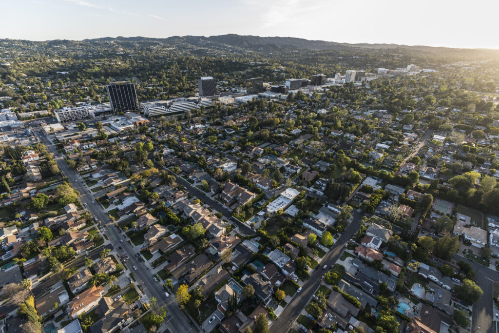
Sherman Oaks is a district of the City of Los Angeles in the southeastern San Fernando Valley, bounded by Studio City on the east, Van Nuys on the north, Encino on the west, and the Santa Monica Mountains and Beverly Crest on the south. It sits in Council District 4, is policed from the Los Angeles Police Department's Van Nuys Community Police Station, and uses 91403 and 91423 as its core residential ZIP codes. Planning jurisdiction is split in two: the southern portion falls under the Sherman Oaks-Studio City-Toluca Lake-Cahuenga Pass Community Plan, the northern portion under the Van Nuys-North Sherman Oaks Community Plan. Anyone searching Sherman Oaks homes for sale should establish which plan and which zoning string govern a parcel before assuming what can be built on it.
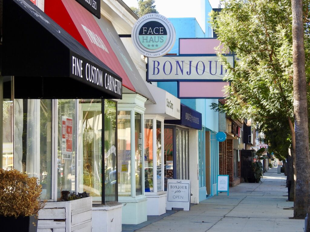
Ventura Boulevard runs the length of the district and does the work of a border. South of the boulevard describes the ground between Ventura and the ridgeline at Mulholland Drive, where Valley Vista Boulevard, Longridge Avenue, Woodcliff Road and Dixie Canyon Avenue leave the valley floor and climb. Beverly Glen Boulevard and Coldwater Canyon Avenue carry traffic over the mountains toward the Westside, and Beverly Glen is one of only six routes linking the Valley to the west side of the city. Near the top, Fossil Ridge Park covers roughly 110 acres at Mulholland and Beverly Glen under the Santa Monica Mountains Conservancy, a state agency, protecting Miocene marine fossils in the Modelo Formation. Elevation, outlook, privacy and grading difficulty rise together as the streets go up.
The western spine is Sepulveda Boulevard and, beside it, Interstate 405 through the Sepulveda Pass. At Ventura and Sepulveda stands the Sherman Oaks Galleria, opened on October 30, 1980 and filmed repeatedly through the following decade, including in Fast Times at Ridgemont High and Valley Girl. It closed in April 1999 and reopened in 2002 as an open-air complex combining roughly 250,000 square feet of retail and entertainment with about 760,000 square feet of offices. A mile east at 14006 Riverside Drive, Fashion Square opened in 1962 with Bullock's and I. Magnin and now carries Macy's and Bloomingdale's. Sherman Oaks Castle Park at 4989 Sepulveda Boulevard, with its miniature golf and batting cages, remains the most recognizable roadside landmark.
North of Ventura the land flattens and the grid takes over. The flats hold the largest concentration of postwar tract housing, organized around Riverside Drive, Moorpark Street, Magnolia Boulevard and Kester Avenue. Two areas joined Sherman Oaks by petition rather than by survey: Chandler Estates and the forty-five block area known as Magnolia Woods both moved across from Van Nuys in 1991, and the City Council added roughly 1,800 further homes from Van Nuys in 2009. The Van Nuys/Sherman Oaks War Memorial Park and its recreation center occupy Huston Street. Beyond the Ventura Freeway the Sepulveda Basin opens up behind Sepulveda Dam, built by the Army Corps of Engineers between 1940 and 1941 after the 1938 floods.
Three layers of regulation shape what a buyer can build. The Baseline Mansionization Ordinance governs floor area on flat single-family lots, the Baseline Hillside Ordinance governs hillside lots by slope band, and the Ventura/Cahuenga Boulevard Corridor Specific Plan governs the commercial frontage along Ventura itself. Sales are also subject to Measure ULA, the City of Los Angeles transfer tax applied to conveyances inside city limits. Public schooling is Los Angeles Unified, with Dixie Canyon Community Charter, Sherman Oaks Elementary Charter and Riverside Drive Charter among the resident elementary schools, and independent options including The Buckley School and Notre Dame High School inside the district. Regulation specific to the parcel and schools that sort locally are why pricing varies so sharply from block to block.
Life Here
The hillside streets: views, privacy and the Valley’s strongest price per foot.
Wide family blocks, remodeled traditionals and the neighbors out walking at dusk.
Ventura’s best stretch: the restaurants and coffee that keep the hill crossing optional.
History
Moses Hazeltine Sherman, born in West Rupert, Vermont on December 3, 1853, reached Los Angeles in 1890 after a career in Arizona that included terms as Superintendent of Public Instruction and Adjutant General. He electrified street railways, built the Los Angeles Pacific Railway, and sat on the city's Board of Water Commissioners from 1903 to 1910 while the Owens Valley aqueduct was being planned. In 1910 he and his partners bought roughly 47,500 acres of the southern San Fernando Valley for about $2.5 million and organized the Los Angeles Suburban Homes Company, the syndicate that laid out Van Nuys, Marian, now Reseda, and Owensmouth, now Canoga Park. Accounts date the transaction to 1909, 1910 or 1911 depending on what is being counted.
Water made the rest possible. Aqueduct water reached the San Fernando Valley in November 1913, and on March 29, 1915 valley voters approved annexation to the City of Los Angeles by 681 to 25, bringing 108,732 acres into the city. Pacific Electric had reached Van Nuys on December 16, 1911. Sherman Oaks itself came later: in 1927 Sherman, working with Thomas Bundy and Charles Albright, subdivided about 1,000 acres and gave the tract his own name, with land offered at roughly $780 an acre. Street names still record the period. Ventura Boulevard follows the El Camino Real alignment and takes its name from Saint Bonaventure, Hazeltine Avenue carries Sherman's middle name, and Coldwater Canyon Avenue was renamed from Diaz Avenue in 1937.
Sherman Oaks filled in after the Second World War. SurveyLA, the city's historic resources survey, identified the Nagle/Varna/Sarah Residential Historic District, roughly bounded by Nagle Avenue, Valleyheart Drive, Varna Avenue and Kling Street, as an intact postwar residential suburb developed between 1946 and 1954, with 114 properties on lots averaging 58 feet wide and 129 feet deep. Boundaries kept moving afterward, with Chandler Estates and Magnolia Woods petitioning across from Van Nuys in 1991. The Northridge earthquake of January 17, 1994, a magnitude 6.7 event on a blind thrust fault, damaged wood-frame apartment buildings across the Valley, closed the Galleria for eleven days and left one Fashion Square anchor dark for four years.
Architecture
The defining stock is the postwar ranch house, and the most recognizable builder is William Mellenthin, born in Minnesota in 1896 and active from 1923 into the 1960s. Mellenthin built more than 3,000 houses across Los Angeles and the San Fernando Valley and signed them with a cupola or dovecote set into the roof, which is why they are known as birdhouse ranches. Diamond-pane windows, brick fireplaces, deep front porches and rambling single-story plans are the other markers. He lived on Ethel Avenue in Sherman Oaks, and the Museum of the San Fernando Valley has run walking tours of his houses. Minimal Traditional cottages from the late 1940s sit alongside them, smaller and plainer, on the same narrow lots.
The hillside built later and differently. Once the canyons above Ventura Boulevard were subdivided through the 1950s and 1960s, the prevailing idiom became post-and-beam modernism: low roofs, glass walls turned toward the valley floor, carports and decks cantilevered over slopes too steep to terrace. The same period produced two commercial landmarks. Casa de Cadillac at 14401 Ventura Boulevard, designed by Randall Duell with Phillip A. Conklin, was built in 1948 and opened in 1949, and the Los Angeles Conservancy treats it as a landmark of San Fernando Valley modernism. The Bullock's store at Fashion Square, by Welton Becket and Associates, was a five-story building of about 280,535 square feet completed in 1962.
The third layer is the rebuild. From the early 2000s onward, flat lots on both sides of Ventura Boulevard were bought largely for their land, cleared, and replaced with two-story houses built to the maximum floor area the code allowed, usually in a transitional farmhouse or soft contemporary vocabulary. The Baseline Mansionization Ordinance, first passed in 2008 and tightened in March 2017 by Ordinance No. 184802, is the direct response. It caps residential floor area in the R1 zone at 0.45 of lot area with a limited bonus, and imposes an encroachment plane beginning at 20 feet and sloping inward at 45 degrees from the required front and side yard setbacks. Original ranches, careful remodels and code-maximum new builds now stand side by side.
Understanding the Market
Price sorts first by side of the boulevard. South of Ventura the lots are generally larger, the streets curve into the canyons, and the buyer pool overlaps with the Westside because Beverly Glen Boulevard, Coldwater Canyon Avenue and the 405 through the Sepulveda Pass all begin there. North of Ventura the grid is flatter and denser, lots are more uniform, and the value proposition is square footage, yard and school proximity rather than outlook. Within the south side the split continues: flat parcels on streets such as Valley Vista Boulevard trade on different terms from view parcels on the ridges above, because flat land is cheaper to build on and view land is scarcer.
On the hillside, buildability moves price more than any other variable. The Baseline Hillside Ordinance, Ordinance No. 181,624, effective May 9, 2011, sets maximum floor area by a slope band method that divides a lot into six bands and assigns a declining floor area ratio to each, so two parcels of identical size can permit very different houses. By-right grading is limited to 500 cubic yards plus five percent of lot size, subject to caps by zone, and lots fronting a Substandard Hillside Limited Street face additional height, access and fire sprinkler requirements. Buyers pricing a hillside parcel should read the slope analysis and the street classification before the comparables.
The 405 corridor cuts both ways. Proximity buys access to the Westside and to Los Angeles International Airport, and it also buys traffic, which is why Sepulveda Boulevard, Beverly Glen Boulevard and Coldwater Canyon Avenue carry heavy cut-through volumes at peak. The Sepulveda Pass improvements of the 2010s added a ten-mile northbound carpool lane between the 10 and the 101 and rebuilt or modified 23 bridge and ramp structures, including the Mulholland Drive bridge. Metro completed a draft environmental report for the Sepulveda Transit Corridor in May 2025 and in January 2026 selected an underground heavy rail alignment between the Van Nuys Metrolink Station and the E Line Expo/Sepulveda Station as its preferred alternative.
Micro Neighborhoods
South of the boulevard is local shorthand for everything between Ventura Boulevard and the Mulholland ridgeline. The ground rises almost immediately, lots grow larger and more irregular, and streets such as Valley Vista Boulevard, Longridge Avenue, Sunnyslope Avenue and Dixie Canyon Avenue carry the district's highest values. Part of the premium is topography and outlook, part is the shorter run over Beverly Glen Boulevard or Coldwater Canyon Avenue to the Westside, and part is elementary attendance, since Dixie Canyon Community Charter draws from this side. Above the flat line, hillside floor area and grading rules replace the standard R1 limits.
Chandler Estates occupies the northern flats between roughly Magnolia Boulevard and Burbank Boulevard, and between Coldwater Canyon Avenue and Van Nuys Boulevard, with Ethel and Tyrone Avenues at its core. The name comes from Chandler Boulevard, itself named for Los Angeles Times publisher Harry Chandler. The area was addressed as Van Nuys after ZIP codes were assigned in the early 1960s, and residents petitioned successfully to be recognized as part of Sherman Oaks in 1991. Housing is predominantly 1940s and 1950s single-story tract construction, now mixed with substantial remodels and code-maximum replacements.
Magnolia Woods is a forty-five block pocket of the northern flats that, like Chandler Estates, petitioned to move from Van Nuys into Sherman Oaks in 1991, a change carried through when Marvin Braude represented the area on the City Council. The blocks are flat and gridded, laid out with concrete sidewalks, uniform setbacks and mature street trees, and the stock is overwhelmingly postwar single-family. Accounts differ on the exact edges, and attendance here runs to northern schools rather than the south-side elementaries, so both should be confirmed against the specific parcel.
Longridge Estates is the name buyers and agents use for the blocks around Longridge Avenue south of Ventura Boulevard, where flat land ends and the first slopes begin. Nearby, Valley Vista Boulevard runs east to west along the base of the hills and carries some of the largest flat lots on the south side. Neither name corresponds to a single recorded subdivision, and sources draw the edges differently, so both are market shorthand rather than legal boundaries. Much of the housing dates from the 1950s, with steady replacement building since the 2000s.
The upper hillside runs from the canyon mouths at Ventura Boulevard to Mulholland Drive along Beverly Glen Boulevard, Coldwater Canyon Avenue, Woodcliff Road and the smaller canyon streets between them. Houses are typically mid-century post-and-beam or later contemporary construction on stepped or cantilevered foundations, valued for outlook and privacy. Development is constrained by the Baseline Hillside Ordinance, and parcels inside the Mulholland Scenic Parkway Specific Plan area, adopted as Ordinance No. 167,943 in 1992, face design review meant to protect views from Mulholland Drive. Fossil Ridge Park sits near the top at Beverly Glen.
Hidden Woods sits in the eastern flats, described locally as running between Magnolia Boulevard and Riverside Drive and between Fulton Avenue and Coldwater Canyon Avenue. It is closely associated with the builder William Mellenthin, who lived on Ethel Avenue and whose birdhouse ranch houses, marked by a cupola or dovecote set into the roof and by diamond-pane windows, are concentrated across these blocks. Many date to the early 1950s. Original houses now stand next to full replacements, and surviving Mellenthins command a premium when they retain their original detailing.
Education
School assignment in Los Angeles Unified follows the parcel, not the neighborhood name or the ZIP code, and boundaries have been redrawn before. Magnet programs, including the performing arts magnet at Louis Armstrong Middle School and the gifted and high ability magnet at Kester Avenue Elementary, admit through the district's separate Choices application rather than by address, and independent charters run their own processes and deadlines. Confirm the resident elementary, middle and high school for any specific address with LAUSD's Resident School Identifier before writing an offer.
Common Questions
Keep Exploring
Work With Ben
Whether the target is a view parcel above Valley Vista Boulevard, a birdhouse ranch in the flats or a rebuild south of the boulevard, the right answer starts at the parcel rather than the neighborhood name. Describe what you want and the search can be narrowed to the blocks that deliver it.
Start the ConversationBen will reach out shortly to set up your tour.