Home / Neighborhoods / Encino
Encino Homes for Sale
A San Fernando Valley estate district built on the historic 4,460-acre Rancho Los Encinos.
Home / Neighborhoods / Encino
A San Fernando Valley estate district built on the historic 4,460-acre Rancho Los Encinos.
About the Neighborhood
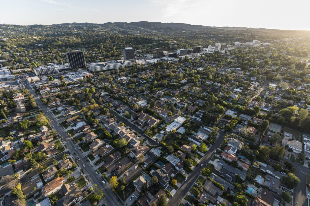
Encino occupies the south-central San Fernando Valley inside the City of Los Angeles, using the 91316 and 91436 ZIP codes. The Encino Neighborhood Council draws its area from Victory Boulevard on the north to Mulholland Drive on the south, and from the 405 Freeway on the east to Lindley Avenue and the ZIP boundary on the west, which puts Sherman Oaks immediately east, Tarzana west, and the Sepulveda Basin and Lake Balboa across the northern edge. Ventura Boulevard runs the length of the community as its commercial spine, with the 101 Ventura Freeway a few blocks north and the 405 climbing the Sepulveda Pass toward the Westside. Buyers searching Encino homes for sale weigh two different products: wide flat lots on the valley floor, and view parcels on the north slope of the Santa Monica Mountains.
Lot character is the defining variable here. Much of Encino was laid out in large pieces, and significant blocks remain zoned RA Suburban, which sets a 17,500 square foot minimum lot area and a 70 foot minimum width, or RE Residential Estate, whose subzones run from RE9 at 9,000 square feet through RE20 at 20,000 square feet to RE40 at 40,000 square feet. Half-acre and acre parcels are ordinary here in a way they are not in Studio City or most of Sherman Oaks. Local convention divides the community at Ventura Boulevard: south of the boulevard covers the estate blocks and hillside streets, north of the boulevard the flat grid running toward the Sepulveda Basin. The two markets are priced separately.
The name predates the city. On August 5, 1769 the Portola expedition crossed the Sepulveda Pass and camped two nights at the Tongva village of Siutcanga, beside a spring that ran year round. Fray Juan Crespi recorded the valley as El Valle de Santa Catalina de Bolonia de Los Encinos, and only the last word survived in common use. In 1845 Governor Pio Pico granted a square Spanish league, roughly 4,460 acres, to three Mission Indians recorded as Ramon, Francisco and Roque. Vicente de la Osa acquired their interests in 1849 and built the adobe that still stands. The Basque brothers Eugene and Philippe Garnier bought the ranch in 1869 and added the two-story limestone building and the pond; Domingo Amestoy, a Basque wool grower, took it in 1889, and his family's later sales produced the modern street grid.
Because Encino sits inside the City of Los Angeles, city rules govern both what can be built and what a sale costs. The Baseline Mansionization Ordinance, Ordinance No. 184802, took effect March 17, 2017 and caps residential floor area in the R1 zone at 0.45 of lot area outside hillside and coastal areas, with separate ratios for RA, RE and RS. The Baseline Hillside Ordinance, Ordinance No. 181624, effective May 9, 2011, governs the Encino Hills through slope-band floor area, height envelopes and by-right grading caps. Ventura Boulevard frontage falls under the Ventura/Cahuenga Boulevard Corridor Specific Plan, Ordinance No. 174052, which sets height tiers, floor area ratios, signage and parking standards across six communities. Measure ULA, in force since April 1, 2023, applies to every Encino sale.
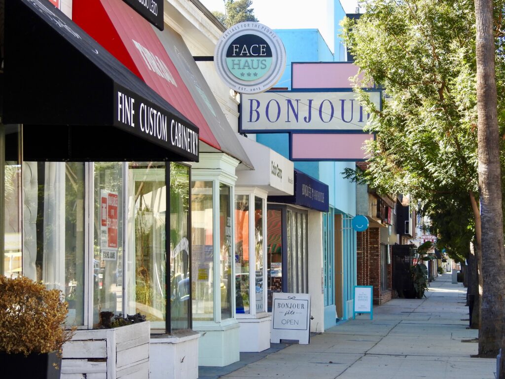
Daily life runs along Ventura Boulevard, where restaurants, banking, professional offices and Encino Hospital Medical Center at 16237 Ventura Boulevard sit within a few blocks of residential streets. Los Encinos State Historic Park at 16756 Moorpark Street preserves five acres of the original rancho, including the de la Osa adobe, the Garnier Building and the spring-fed pond, and carries California Historical Landmark No. 689. North of the freeway, the Sepulveda Basin holds the Encino and Balboa golf courses, Lake Balboa at Anthony C. Beilenson Park, a 130-acre wildlife area, ball fields and the Encino Velodrome on Oxnard Street, a nonprofit outdoor track since 1961. The Encino Reservoir, an LADWP facility completed in 1924, sits in the hills above.
Life Here
Gates, motor courts and flat half acres: the Valley’s answer to Holmby, at Valley math.
South of the Boulevard, view streets climb toward Mulholland and the city line glows at night.
The Sepulveda Basin’s trails, lake and golf keep weekend life inside the zip code.
History
Siutcanga, the Tongva settlement at the Encino spring, was substantial enough that the 1769 Portola expedition recorded a detailed description of it before moving north. Mission San Fernando Rey de Espana, founded in 1797, absorbed the surrounding land, and after secularization Governor Pio Pico issued the Rancho Los Encinos grant in 1845 to three men who had worked the land since about 1834, recorded as Ramon, Francisco and Roque. Vicente de la Osa took over their interests in 1849 and built a long adobe farmhouse, described in different accounts as having eight or nine rooms. The United States patented the grant to de la Osa and others on January 8, 1873 for 4,460.73 acres.
The rancho passed through several hands before Eugene and Philippe Garnier, brothers from the French Basque country, bought it in 1869. Eugene Garnier built the two-story limestone farmhouse that now serves as the park visitor center and, in 1874, the stone pond fed by the natural spring. The Garniers lost the property to foreclosure in 1878. Domingo Amestoy, born about 1822 near Bayonne and by then one of Southern California's largest wool producers, acquired roughly 4,500 acres in 1889 and died on January 11, 1892, after which his sons ran the ranch. Accounts differ on the timing of the first large subdivision sale, placing it in 1915 or 1916, and on the family's final departure, which sources give as either 1944 or 1945.
Water settled the question of Encino's future. The Los Angeles Aqueduct reached the valley in November 1913, and because city water could not be sold outside city limits, valley property owners voted on March 29, 1915 to annex to Los Angeles, carrying the measure 681 to 25 and bringing in 108,732 acres. Encino came into the city with that annexation. Through the 1920s the former Amestoy ranch north of Ventura Boulevard between Balboa and White Oak Avenues was platted as Encino Acres, with parcels of two to twenty acres sold for country places, hobby ranching, citrus and walnuts. Growth accelerated after the war, when San Fernando Valley population doubled to just over 400,000 between 1945 and 1950. The Ventura Freeway was completed in 1960 and the San Diego Freeway in 1961.
Architecture
The oldest surviving residential stock reflects the estate and gentleman-farm era. SurveyLA, the city's historic resources survey for the Encino-Tarzana Community Plan Area, records Colonial Revival and Tudor Revival houses of the 1920s and 1930s on the large Encino Acres parcels, along with individual properties such as the Al Jolson estate at 4875 North Louise Avenue, built in 1935, and the Clark Gable and Carole Lombard house at 4543 North Tara Drive, dated 1933. These were rural properties when built, set well back from the road on acreage, with stables, orchards and walnut groves. Few survive on anything like their original land, but the deep setbacks and mature oaks they established still shape several Encino streets.
The postwar ranch house is Encino's defining type. SurveyLA identified the Encino Woods Residential Historic District, centered near Noeline Avenue and dating to 1951, and the Hayvenhurst Drive Residential Historic District of 1956, a run of one-story houses in Traditional, Cinderella, Minimal, Regency and Contemporary Ranch variants laid out on curvilinear blocks. Encino Village, a large 1955 subdivision credited by the survey to architect Martin Stern on the former RKO Studio Ranch, brought the type to the valley floor at scale. Because these houses sit low and wide on generous lots, they remain the most common candidate for expansion or replacement in Encino, and the floor area caps that govern the replacement are the practical constraint on what follows.
Modernism is well represented in the hills. The survey notes concentrations of architect-designed mid-century residences in Royal Oaks, Royal Woods and Castle in the Woods, and names Ray Kappe, Richard and Dion Neutra, Richard Dorman, Daniel Saxon Palmer and Edward Fickett among architects who worked in the area; the Phineas Kappe Residence at 15541 West Woodcrest Drive, built in 1955 to a Ray Kappe design, is one recorded example. The Escalon Drive Historic District, running between Empanada Place and Standish Drive, dates to 1966 and consists of mid-century modern tract houses by Dan Saxon Palmer. Layered over all of it since the 1990s is a newer estate vocabulary: traditional and Mediterranean forms on the flats, gated motor courts, and hillside contemporary work oriented to the valley view.
Understanding the Market
Price in Encino is driven first by the lot. A wide, flat, deep parcel south of Ventura Boulevard supports a large single-level or two-story house with a lawn, pool and motor court, and that combination sets the top of the flat-land market. Hillside parcels trade on view, privacy and buildable pad rather than on land area, and the two are not interchangeable at the same price. Within the flats, frontage width and depth matter more than raw acreage, because setbacks and floor area are calculated against them. Zoning follows the same logic: an RA or RE40 parcel carries a very different development envelope from an R1 lot of similar street frontage, and that difference is priced.
Buildable envelope is the second driver. Outside hillside areas the Baseline Mansionization Ordinance caps R1 residential floor area at 0.45 of lot area, with separate ratios in RA, RE and RS, so a buyer paying for land is really paying for the house that land will legally carry. In the Encino Hills the Baseline Hillside Ordinance replaces that with slope-band floor area, height envelopes running roughly 22 to 36 feet depending on zone and slope, a 40 percent building coverage limit above six feet of grade, and by-right grading of 500 cubic yards plus five percent of lot area subject to zone caps. Parcels within a half mile of Mulholland Drive also fall under the Mulholland Scenic Parkway Specific Plan, Ordinance No. 167943, adopted May 13, 1992, which adds design review.
Measure ULA is the third. The city's base documentary transfer tax is 0.45 percent, charged at $2.25 per $500 of value. On top of that, for transactions closing after June 30, 2026, sales above $5,400,000 and up to $10,900,000 carry an additional 4 percent, and sales of $10,900,000 or more carry 5.5 percent. The tax is calculated on the full consideration rather than only the amount above the threshold, so crossing $5,400,000 adds more than $216,000 of tax on the first dollar over. Encino carries enough estate product in the $4,000,000 to $7,000,000 range that the first threshold visibly shapes list prices and negotiation. The thresholds are adjusted annually against a federal price index.
Micro Neighborhoods
Amestoy Estates takes its name from Domingo Amestoy, the Basque wool grower who acquired Rancho Los Encinos in 1889 and whose heirs subdivided it. The tract sits north of Ventura Boulevard on the valley floor, within the belt the city's historic survey describes as the former Amestoy ranch between Balboa and White Oak Avenues. Streets are wide, lots are flat and generously sized, and the housing mix runs from original ranch houses through substantial additions to full replacements. The Encino Property Owners Association has represented residents here on matters including the Amestoy pedestrian bridge over the 101 Freeway.
Encino Village is a large tract laid out in 1955 on the former RKO Studio Ranch, with the design credited by SurveyLA to architect Martin Stern. It sits on the flats and reads as a coherent postwar subdivision rather than a collection of one-off estates: consistent setbacks, single-story ranch houses on rectangular lots, and street trees planted at the same time. Pricing generally sits below the south-of-the-boulevard estate blocks, which makes it one of the more accessible ways into Encino, and the uniform lot dimensions make the floor area arithmetic straightforward for buyers planning an addition or a rebuild.
Royal Oaks and Royal Woods, with the adjacent Castle in the Woods tract, occupy the southeastern hills of Encino. The city's historic resources survey singles them out for a concentration of architect-designed mid-century modern residences, and names Ray Kappe, Richard and Dion Neutra, Richard Dorman and Edward Fickett among the architects who worked in the area. Streets curve with the terrain, lots step up or down from the road, and views open north across the valley. Buyers searching Royal Oaks Encino treat the area as one market, though the recorded tracts are separate; confirm through title whether any association or gate governs a given parcel.
Encino Hills is the general name for the slopes rising south of Ventura Boulevard toward Mulholland Drive, taking in streets such as Lake Encino Drive, Escalon Drive and Woodcrest Drive. The Encino Reservoir, an operating Los Angeles Department of Water and Power facility completed in 1924 and rebuilt in the early 1960s, lies within these hills. Development is governed by the Baseline Hillside Ordinance rather than the flat-land rules, and parcels within a half mile of Mulholland Drive also fall under the Mulholland Scenic Parkway Specific Plan and its design review board. Fire mapping, brush clearance and insurance are material on every purchase here.
Hayvenhurst Avenue runs north to south through Encino and is associated with some of the community's widest estate frontages on the valley floor, with long driveways set behind hedges and walls. Higher up, the city's historic survey identified a Hayvenhurst Drive Residential Historic District dating to 1956, a run of one-story ranch houses in several stylistic variants on curvilinear blocks. The two are different environments sharing a name: the avenue is flat-lot estate territory where lot depth and width drive value, while the drive is an intact postwar hillside tract whose interest is architectural consistency rather than parcel size.
The streets around Tara Drive occupy the site of the ranch once owned by Clark Gable and Carole Lombard. The house survives and appears in the city's historic resources survey at 4543 North Tara Drive with a construction date of 1933. The Valley Relics Museum records that the original address was on Petit Drive and that it changed when the property was sold in the 1970s, after which the surrounding acreage was subdivided into conventional residential lots. Buyers who ask about the Clark Gable estate area mean these blocks, which are flat, quiet and now largely rebuilt at contemporary scale.
Encino Acres was the 1920s subdivision of the former Amestoy ranch north of Ventura Boulevard between Balboa and White Oak Avenues, sold in parcels of two to twenty acres for country places, citrus and walnut planting. Almost all of it has since been resubdivided, but the legacy is a northern flat grid with unusually deep lots and a scattering of surviving equestrian-scale parcels. This is where most Encino horse property questions land, because lot area and zone, not tradition, determine whether horses are permitted. The Sepulveda Basin, Balboa Boulevard and the Encino Golf Course sit at the top of this area.
Education
School assignment in Los Angeles Unified follows the parcel, not the neighborhood name, and a boundary can split a single street between two campuses. Magnet programs and charters run separate application processes with their own deadlines and do not follow residence. Older Encino students are commonly served by Gaspar de Portola Charter Middle School in Tarzana and Birmingham Community Charter High School in Lake Balboa. Confirm resident schools for any address through LAUSD's Resident School Identifier.
Common Questions
Work With Ben
A flat estate lot in Amestoy Estates, a mid-century house in Royal Oaks and a view parcel in the Encino Hills are three different decisions. Describe what you are looking for and it can be measured against what is actually available.
Start the ConversationBen will reach out shortly to set up your tour.